Monday 17 October 2011

Almost the last leg!

Set off at 10ish on 3rd October (Monday) and, after a few train changes, I got to Holyhead at 16:30. We didn't have the replacement auto-helm so Craig Steadman asked his mate Les, to accompany us. We sailed at about 19:00. The weather was windy and the seas rough, with 1 to 2 metre swell. We made reasonable progress sailing with full main and Genoa. After about 2 – 3 hours, after we had cleared ‘The Skerries’


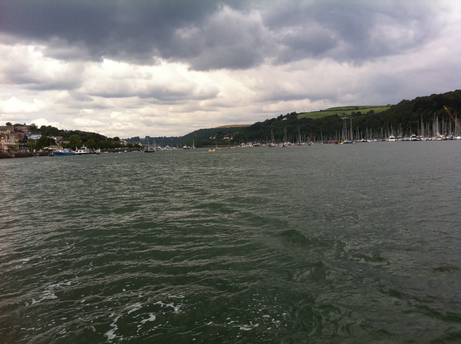
The Skerries in daylight and kinder seas.


and ‘Carmel Head’ it was then dark. We lit up the navigation lights etc. and switched off the engine (and fridge), to sail through the night. We were doing 7 or 8 knots over the ground, heading 20 / 30 degrees. By the time five hours had passed it was obvious that the seas were rising – it was a clear night, (beautiful stars sprinkled across the heavens), but the wind steadily increased to 28 knots, gusting 30. We ‘gybed’ accidentally as the bow got smashed by the waves, (I was on helm), and then agreed to quickly take off the canvas. Craig was brilliant – strong and decisive, getting the sails in pretty smartly. By now the seas were deep and following, with spray everywhere. The three big ships we saw were moving up and down a fair bit too. We motored on through this but it was getting uncomfortable. Craig didn’t feel brilliant, so Les and I did most of the helming and for the last two hours he did – I just chatted to him. We had decided to go into Douglas, Isle of Man, by this stage. Another 10 hours of buffeting wasn’t something we wanted to do.


Entry to the harbour was gained from the N.E. (heading 229) following leading marks, (white opposing triangles). These were illuminated at night by flashing, (occulting 10s), blue lights, supplemented by red flashing opposing arrows. This approach avoided possible overfalls at the end of the Breakwater. It was good to be out of the rough seas and into calmer waters. The fairway was marked by two Starboard hand buoys (Q(3)G.5s) & (Fl.G3s) and to Port a concrete ‘dolphin’ (2F.red vert). This marks the end of the Breakwater. The Pilot Book warns that, at the entrance, tides of up to 2 knots to the North East and South could be expected during flood and ebb tides respectively.


A stylised chart of the 'new' Douglas Harbour


When we radioed the harbour for times of the bridge raising, the duty harbour master asked whether this meant we had come down the fairway without permission! It was after three o’clock in the morning for goodness sake, on a filthy night, with high seas and Force 8 winds! He also never mentioned the outside pontoons we could have tied up to (and slipped at any state of tide and got away!). Revenge? The local marina officer apologised about this misery's behaviour later.


The Bridge


The flap gate beneath the bridge apparently ensures that water remains in the harbour, keeping the marina afloat – just! The bridge itself seems to be operated (lifted) every half an hour at 15 minutes and 45 minutes for 2 hours every high tide, when it can be lifted to allow boats in and out of the harbour. Though it appears at rush hour this may not happen – so avoid later than 4pm and earlier than say 5:30 pm (is it just tough-luck if the tide is thereabouts?).


We moored up at pontoon B23 – with only half a foot under the keel we reckoned! By 5:30 am we had finished mooring, and having a welcome cup of tea, whilst we changed and dried out. We slept until 0830 – though by the time I surfaced second, Les was already ashore, (without any idea of the code to get back into the marina!), – so Craig and I went off to have breakfast in the market. Then we paid our dues in the marina office and got the weather forecast. Craig and I walked around town whilst Les got his head done. Then I went to the Ferry Terminal for a Wi-Fi connection to look up train times, weather forecast etc. and tides for our departure/arrival in Maryport. Craig and Les went down to the RNLI to have a cuppa and a chat.


Douglas from the air. Our berth was in the inner marina - just in the top right quarter of the photo above.


After some considerations of the forecast we cast off at 3 pm – the earliest we could get out – in spite of the Met Office predicting a forecast Force 8 - here’s the detail from Navetex!


GALE WARNING


TUESDAY 04 OCTOBER 0937 GMT 55 SOUTH UTSIRE SOUTHWESTERLY GALE FORCE 8 CONTINUING FORTH SOUTHWESTERLY GALE FORCE 8 CONTINUING IRISH SEA SOUTHWESTERLY GALE FORCE 8 EXPECTED LATER


So it was a case ‘go for it' or get stuck from now, (Tuesday), until the weekend. The Harbour Authorities didn’t want us to leave boat unattended. So we set off, with two deadlines or points of departure, both of which meant a return - if we judged the sea state too tough to keep going in. The weather for the first four hours was cloudy but we had decent enough weather. We decided to motor all the way, given the forecast - Les and Craig did almost all of the helming, although I felt fine. They looked like they were enjoying grappling the tiller against some fairly strong waves.


We made great time and passed our two key points in pretty decent weather and then I sat at back of cockpit, snug for most of journey. I was comfortable, warm and dozed off. By the time I woke up the waves were about three metres high. Craig took over the helm and Les and I watched - as best we could - for tricky waves, to give him some warning.


We did well on time, though it was dark now and really lumpy. We motored on as best we could but it was getting hairy. It was about one o’clock in the morning and Maryport couldn’t be accessed until 5am or thereabouts. Craig found Workington described as a 'safe refuge' so at about one thirty-ish we slipped into Workington (Location: Latitude 54º 39'N, Longitude 3º 35'W - Admiralty chart no. 2013: St. Bees Head – Silloth). This involved a fair run up the lee shore in cross winds and rough seas so it wasn’t pleasant. Then, at last, we lined up on the blue lights guiding us in and got into the outer harbour. This was sheltered, but with nowhere to moor and anchoring in this fairway to the port was forbidden. Be blowed, we anchored. Then Craig called up Liverpool Coastguard - to no effect on VHF - so we rang them on my mobile. He explained the situation. The lady coastguard helped us, (after recovering from the shock of realising we had come on from the Isle of Man), and in no time at all we got permission to tie up, rafting, on the Workington Lifeboat – 'Sir John Fisher' - a Tyne class lifeboat.


(This type was the first ‘fast’ slipway lifeboat but this particular one lies afloat. The features include a low-profile wheelhouse and a separate cabin - behind the upper steering position and the propellers are protected by substantial bilge keels. The last Tyne was built in 1990 - though this had been refurbished - and the class is being gradually replaced by the Tamar class).


The local RNLI Coxswain, John Stobbart, had ‘okayed’ our berthing alongside but also warned us that "in this wind and sea no sensible person would go back out!" So this meant failing to reach Maryport – only 4.5Nm north of Workington! Oh well … that;’s sailing for you.


Workington Harbour - the lock gates guarding the port. (In daylight!).


So we waited until the lock gates opened at 04:15 and then entered the Prince of Wales dock. The maximum depth of water in here is 10.2 metres during spring tides and 7.2 metres during neap tides. Tidal predictions are stated relative to the dock gate cill, which is 1.16m below Chart Datum. The Port operates an enclosed dock to keep berthed vessels afloat during the low water period. The dock gates are opened up to 2.5 hours prior to high water and close up to 2 hours after, dependent on the draft of vessels at berth in the dock.


We moored up – it all seemed so dodgy – the quay walls were 20 foot walls; access to the sock was up rusting ladders in quayside walls. Les went up as we hauled the boat close enough for him to reach the ladder, then we stood off. He got soaked in the rain lashed night, waiting for Craig to successfully land a line for him to pull up with the warps attached. We needed really long warps too and the springs just about managed – tied to he top of the ladder. We had already hung out all the fenders on starboard side. We got the luggage and rubbish off and with fingers crossed climbed out – signed off with the harbour master and got a taxi to the rail station. We shared a train from Maryport to Carlisle then Craig and Les headed off on the Euston train to change at Warrington, then Chester then home to Holyhead. My train left Carlisle an hour later but was the Carlisle – Settle – Leeds train. I got off at Skipton and Sophie picked me up. A stunning rail journey to finish an eventful three days!

Thursday 29 September 2011

Milford Haven to Holyhead - 26th to 28th September 2011 and the called off attempt previously 2 Sep 2011


Got the long train journey south from Ilkley via Manchester, heading back to Milford Haven to continue the second leg.

Stan boarded at Newport and we did the shopping at Tesco before getting a taxi to the marina. Cryptic was in good nick - had a slight smell of diesel but she was as dry as a bone. Sorted her out, then had dinner, after touching base with the marina staff. Then we went to the local pub to watch England in Sofia - good result against Bulgaria - 3-0.


Slept well and next morning, (it was blowing and raining), we had a full English breakfast then bought the Irish Imray chart folio for the Dublin area and approaches.

The lady who served us said something to the effect of "I'm glad I am not out in this!". The Shipping Forecast was something like thisWind - West, backing southwest later, 5 to 7.Sea State - Moderate later becoming rough or very rough. Weather - Squally showers, then rain.Visibility - Moderate, occasionally poor.

Dennis Turner, one the Habourmasters, on the Marina staff, seemed confident that we would be back too. Told us we could use the same berth! We set off after breakfast and fueling up - 24.3 litres - at around 10:30. Motored down the Haven until almost the last unloading/loading pier, then decided to turn back when Stan found a train departing at 15:10.


The wind had been buffeting us under bare poles whilst we motored down a safe channel - inside the Haven. At sea it must have been v. rough. As Stan said "If we escaping from the Nazis with the invasion plans, we would press on ... but we're not!"


We tied up, (after I berthed her well - right up until I decided to reverse a bit and almost pulled Derek into the water!). Then we got a taxi to the station, where we boarded the train but not before Stan got involved with a widow! Good customer service received from the train conductor and, in spite of the weirdos we met on route, we landed safely in London and I had a welcomed stay at Stan & Jane's.

Next morning I bunked off earlish to get to Alison and Peter's so we could drive down to visit her and Margaret's cousins.

Back home and with some time to look at matters - Wednesday 10:30 - the latest forecast for the Irish Sea is Wind West, backing southwest later, 5 to 7. Sea State - rough or very rough. Weather - squally showers, then rain. Visibility - moderate or good, occasionally poor.

http://easytide.ukho.gov.uk/EASYTIDE/easytide/ShowPrediction.aspx?PortID=0494&PredictionLength=7

Leg Time 1 day 18 hrs 24 mins
Rhumb Line Distance: 192Nm (bearing 18°)
Safe Sailing Distance: 212Nm

DEPARTURE: MILFORD HAVEN 51°40´·13N 05°08´·16W

HW 6.8m 04.52
Moonrise 04.53
Sunrise 06.12
LW 0.9m 11.08
HW 7.2m 17.11
Moonset 17.16
Sunset 18.10
LW 0.6m 23.36

DESTINATION: MARYPORT 54°43´·03N 03°30´·38W

LW 0.4m 05.57
Sunrise 06.10
Moonrise 07.46
HW 10.0m 11.15
Moonset 17.50
Sunset 17.59
LW 0.7m 18.11
HW 10.2m 23.32


I went down to Milford Haven on Sunday - 09:21 from Ilkley - changing at Leeds/Manchester Piccadilly and arrived in Milford Haven on a blustery wet night at 19:30.


Tesco's closed at 16:00 on a Sunday so I bought some milk at the garage and took a taxi to Neyland's Marina. No one about, but luckily I remembered the pontoon pass code and got on the boat, made a drink and slept!


Next day I aired and cleaned the boat, bought some extra derv cans, and filled up. Then went shopping, timing the finish to the train arrival. Then Stan and I took a taxi back at 16:30ish.


Found out the marina club doesn't cater Mondays(!), so after a pint, we slipped and set off. Our plan was to blitz the passage and end up offshore Maryport ready for an entrance just after lunch on the morning of 28th - after two nights a day and a morning sailing

Stan set a good safe margin using way-points that took us well outside to the west of The Smalls. This is the most remote light of Trinity House.

(the picture, by Catherine Davis, shows what we might have seen in daylight!

As it was we saw only the light flash - 2 flashes of 12 seconds' duration every half minute, at position 51° 43'.23 N 05° 40'.10 W - about 20Nm west of St David's peninsula; the setting for a gruesome lighthouse story. So again thanks to the necessary late departure we missed Skomer Island, The Bitches and Horse Rock etc. ... as a passage through Jack Sound would have entailed. But safety first ... and nothing other than slack water and sound daylight would tempt me there!

The northerly way point too, was some way off west of Anglesey for clearance of that coast.


The Irish Sea was disturbed but we made decent progress through the early part of the night. In the late night (about midnight) the tide shifted against us and slowed our progress until about 5am in the morning. It was slow and boring going for most of the day and it wasn't helped by the fact Stan was tired and feeling queasy. We sailed with the jenny for about 7 hours and the auto-helm was used almost non stop most of the night and day. The only relief sea-wise was a couple of pods of Dolphins accompanying us for a small part of the journey twice.


At Stan's instigation we refueled after 24 hours - using 3.5 X 5 litres of derv. We motored more than we wanted to - given the sea state, wind and weather. For my part I think I must have dropped off a few times but did the helming on the last section as we decided to call it quits and head into Holyhead. Overall we probably covered 200 Nm in about 40 hours.


At about 11:30 or midnight the engine gave out. We were about 4 miles west of Holyhead breakwater. I panicked given that we were in a shipping lane (the Irish ferries) and I thought I had under-fueled her. Stan was not as certain, fancying he heard the engine stop quickly rather than splutter. I put 2.5 to 3 litres in then she overfilled ... so it wasn't lack of derv. The wind was too variable and light to let us sail in ... as Stan's immediate reaction was - i.e. to put the sails up. My worry was that there was no wind and we were in the Irish Farry lane - these boats are FAST.


So we called the Coastguard who launched the Holyhead All-weather Life Boat - a Severn class

RNLB 'Christopher Pearce'

The Lifeboat reached us within 15 minutes or so, and took us under tow. We had drifted a fair bit but got in and tied up at about 2 am. I was tired and cold - Stan had recovered and was quite buoyant. The tow was exciting (though I was too tired and cold to appreciate just how much fun it was!). The stern wave was something to behold! After mooring up we hit the sack and we slept until about 0900 the next day!

Craig Steadman

Next morning Craig Steadman got his wet suit on and cut off the net repair - we took a photo of the troublesome beast then dumped it in a bag in the waste!

After sorting out the marina etc. and Stan chatting to Tom (!) we quit Holyhead and headed for home.

The start of our rail journey was memorable for Stan leaving his wallet at the buffet (probably my fault for carrying his rucksack as well as my gear as we set off!). Thanks to Arriva's excellent staff this was only an inconvenience as Stan returned and picked it up and caught a later train. He was home for 21:45. I only just beat him - 20:15 - thanks to problems on Leeds to Ilkley train!

The rescue is on the latest shout page of the Lifeboat though the seas weren't rough - we just had no power and were drifting a lot so still very grateful to the crew. See the archives of the Holyhead Lifeboat web page ..... start from here http://www.holyhead-lifeboat.co.uk/

This is the actual entry

32 28th Sept 2011 23-40 PM

Holyhead Coastguard requested launch of Holyhead ALB to assist a 32ft sailing vessel 2 pob 4 miles west of holyhead breakwater ,the vessel had a large fishing net wrapped around its propeller and was unable to make her way in rough seas .the volunteer crew arrived and successfully passed a tow and the vessel was towed to holyhead marina lifeboat was refuelled and stood down at 02-30 am, Holyhead coastguard mobile unit assisted with casualty at the marina many thanks for your help Holyhead coastguard co-ordinated the call

Friday 26 August 2011

Hurricane Irene late August 2011

Hurricane Irene is currently (0600 GMT) located around 200 miles (330 km) due east of Titusville, Florida, with winds of 115 mph (185 kmph). It is tracking northwards at 14 mph (22 kmph), and current forecasts have it making landfall in North Carolina Saturday afternoon as a Cat 2/Cat 3 hurricane. It will continue along the eastern coast towards New Jersey and New York, where a Hurricane Watch is currently in effect.

The Irish weather forecast predicts that … the remnants of Hurricane Irene will end up as a depression somewhere southwest of Iceland, but there is some diffence of opinion between the models as to how strong this will be. This will have a bearing on what happens to the high pressure. It will most likely shift to our southeast, possibly allowing some increased cloud and light rain bands in later in the week.

The UK Outlook for Tuesday 30 Aug 2011 to Thursday 8 Sep 2011 from the Met Office is as follows: Largely dry with a mixture of cloud and bright or sunny spells during the middle part of next week. Whilst many regions look set to then remain mainly fine and dry through the rest of the next week, some western and southwestern areas are likely to turn more unsettled with showers or longer spells of rain. These unsettled conditions may then spread into other parts of the UK during the weekend and start of the following week; eastern and southeastern Britain then most likely to hang on to more settled weather. Some chilly nights, especially in the North. Meanwhile, daytime temperatures are expected to be largely around average during the middle part of next week; some indication of warmer conditions developing over southern, eastern and central UK later next week. Updated: 1217 on Thu 25 Aug 2011


"Saffir-Simpson Hurricane Scale"

All Hurricanes are dangerous, but some are more so than others. The way storm surge, wind and other factors combine determines the hurricanes destructive power. To make comparisons easier and to make the predicted hazards of approaching hurricanes clearer to emergency managers, National Oceanic and Atmospheric Administration's hurricane forecasters use a disaster-potential scale which assigns storms to five categories. This can be used to give an estimate of the potential property damage and flooding expected along the coast with a hurricane.

The scale was formulated in 1969 by Herbert Saffir, a consulting engineer, and Dr. Bob Simpson, director of the National Hurricane Center. The World Meteorological Organization was preparing a report on structural damage to dwellings due to windstorms, and Dr. Simpson added information about storm surge heights that accompany hurricanes in each category.

One 74-95 mph No real damage to building structures. Damage primarily to unanchored mobile homes, shrubbery, and trees. Also, some coastal road flooding and minor pier damage
Two 96-110 mph Some roofing material, door, and window damage to buildings. Considerable damage to vegetation, mobile homes, and piers. Coastal and low-lying escape routes flood 2-4 hours before arrival of center. Small craft in unprotected anchorages break moorings.
Three 111-130 mph Some structural damage to small residences and utility buildings with a minor amount of curtain-wall failures. Mobile homes are destroyed. Flooding near the coast destroys smaller structures with larger structures damaged by floating debris. Terrain continuously lower than 5 feet ASL may be flooded inland 8 miles or more.
Four 131-155 mph More extensive curtain-wall failures with some complete roof structure failure on small residences. Major erosion of beach. Major damage to lower floors of structures near the shore. Terrain continuously lower than 10 feet ASL may be flooded requiring massive evacuation of residential areas inland as far as 6 miles.
Five greater than 155 mph Complete roof failure on many residences and industrial buildings. Some complete building failures with small utility buildings blown over or away. Major damage to lower floors of all structures located less than 15 feet ASL and within 500 yards of the shoreline. Massive evacuation of residential areas on low ground within 5 to 10 miles of the shoreline may be required.


Monday 22 August 2011

Sailing weekend, from Friday 19th August 2011

Set off to Largs in the late afternoon (4.15ish), with Steve and his two friends - Steve & Nigel. Had a pleasant but late meal in Scotts, within the Largs Marina and then slept on board 'Wavecrest' - Steve's Sadler 34. We set off at roughly 9.30 for the Kyles and the top of Bute, so we could sail down the west kyle and then up Loch Fyne to Portavadie, opposite Tarbert, (which is also on the mainland - part of the peninsula of Kintyre), for the night at Portavadie marina.

The Kyles is a narrow sea channel which separates the northern end of the Isle of Bute from the Cowal peninsula, (part of the Scottish mainland). The narrowest strait is only about 300 yards across, (the Calmac ferry operates from Rhubodach (Bute) to Colintraive (mainland).

The Kyles are split into the east and west kyles. The east kyle (An Caol an Ear) runs from Rothesay Bay north west up to the entrance to Loch Riddon. Here at the northern end of the east kyle are the Burnt Islands and the island of Eilean Dubh, whih we have to sail near to get to the west kyle (An Caol an Iar/An Caol Ceathrach), which runs from here south west, past the village of Tighnabruaich out to the Sound of Bute.

Bute is divided in two by the Highland Boundary Fault. North of the fault the island is hilly and largely uncultivated, (mostly forests), whereas to the south the terrain is smoother and more farmed - though in the far south the island's most rugged terrain is found around Glen Callum. Loch Fad is Bute's largest body of freshwater and runs along the fault line.

Thursday 28 July 2011

Maiden Voyage of 'Cryptic', 19th July 2011...

... after refurbishment at Yachting Sports, Hamble Point Marina,


Departure Point - North 50 degrees 43 minutes // East 1 degree 27 minutes at 16.30; log reading 3.644; course steered 240 M; wind speed 12 knots SW; Barometer 996; wind W/SW 3 to 4 knots – veering NW later, occasionally gusting 5 knots. Sea was moderate to rough and visibility good occasionally poor with showers later.


Departing Hamble Point Marina, Hamble, near Southampton heading for Maryport, Cumbria.


DAY ONE – Tuesday 19th July – Hamble to Portland: First port of call aimed for was Weymouth. We motored being unhappy with the time we had with the strangely rigged boom and given the rough seas. As we dropped past the Needles the seas were quite choppy, but the boat cut nicely through the waves.


Got intercepted off the Lulworth Ranges, by the range officer in a patrol boat off at around 19:00 … and he asked us, via VHF, very politely, to steer 255 M for 5 nm, to clear the range.


This cost us dear – about two to three hours. We got into Weymouth quite late – about midnight. We motored quietly down the marina looking for a berth but it would have meant rafting in a row of three or four – not guaranteed to make us popular at that time of night! We pulled out and circled the bay whilst considering our next move. Had some tinned ‘Irish Stew’ from tins that I prepared and perhaps the kindest thing that could be said was that it was warm! We berthed in Portland Marina*, (very new and lovely it was too!) and we were greeted by the night berthing “officer”! 53 Nautical miles (Nm) covered and now knackered we slept until about 0900 next day.


*Portland Marina has no natural inlet giving shelter for its 600 berths so a 860m-long breakwater has been built to safely put in network of pontoons. (that are still being installed - couldn't get fuel!). It cost £27 million, and is built on a former Royal Navy Air Site, part of an overall plan of the South West Regional Development Agency and will play an important role in the sailing events for the London 2012 Games when its on-shore facilities and 250 of its berths will be dedicated to the occasion. Prior to the Games. The marina is an approved training centre for Olympic teams - the neighbouring Sailing Academy is home to Team GB, and the Royal Yachting Association (RYA) has based its training camp at the marina to support training ahead of the Games. We saw some of the competitors and their coaches.


Also noteworthy on the South West coast was the number of gannets seen ... and many fishing by plunging into the sea.


DAY TWO – Wednesday 20th July – Portland to Dartmouth:
Filled up with breakfast (Bacon & Egg Paninis), and tea then the fuel tanks (by hand as the fuel bunker/pontoon was being moved and was unconnected) … I thought I was getting a 10 gallon jerry-can free for one moment! We put about 17.5 litres in the boat’s tank. We sailed with two full 5 litres plastic cans plus a 5 litre plastic can with about a half in at 14:00 hours, expecting a 0.5 knot tide against us until 15:00 when we should pick up a westerly wind and a 3 knot tide until about 2000 that evening, (HW Dover + 5 hours). The barometer was rising – to 1002 m/b. We set a course for Dartmouth, still motoring for reasons already stated. We had more kindly seas but still we didn’t get into the Dart until dark.


It was around 23:00 we berthed at what turned out to be a pontoon space big enough for a 12 metre, which is what was coming in shortly we were told at 09:00 – so move little boat! In fact the marina guy was very pleasant and we moved to a more convenient berth in a delightful, sunny morning. We moved, hooked up and had our usual shower etc. then got the water taxi into the town, where we had a full breakfast in a pub, watched Atlantis land (end of the Space Shuttle!), did a little shopping for lunches and headed back to the boat. Nice place Dartmouth!


DAY THREE – Thursday 21st July – Dartmouth to Plymouth:

We departed N50.08.61 / E -04.13.99 for Plymouth, after filling up, after a 10 minute delay at the fuel bunker (we put in 21.68 litres* – including topping up the 5 litre half empty plastic can), at about 13:00.

* My calculation was that the boat had done 9 hours motoring on about 19 litres – roughly 2 litres an hour – Ron’s estimate).


We reached Plymouth - picture of Drake's Island and moored up, helped by “Roger,” (not his correct name!), and Daz, (proper name), his Yorkshire terrier, at 20:00. He was on a Sweden 340 but had in the past owned a Contessa 32. We met up later in the bar where we had a meal together. He was retired, and sailing to the Med, via a visit to his daughter in Northern Brittany. He would winter in Malta and decide whether to do more of the Med or go off for the Caribbean the year after. Actually on reflection it all sounded a bit sad.


DAY FOUR – Friday 22nd July – Plymouth to Falmouth: Didn't refill and breakfasted on the boat. Sailed at 0930 with the barometer rising still, at 1012. Forecast suggested 3 to 4 occasionally gusting at 5 with mixed visibility and possibly rain. We had the sails up for a while and she handled well ... did 39 Nm and got into Falmouth (impressive entrance), but had to raft up (three of us), at around 18:45 – 35Nm.


We had time to get out and eat at a local restaurant - v. small port-like and the old type of seaside place- mackerel and rabbit - both wrapped in pancetta & then hake. We both liked Falmouth - it is sure to be worth a visit another time.


DAY FIVE – Saturday 23rd July – Falmouth to Milford Haven:
144Nm Set off sailing on this, the big leg! But before we got too close to dusk and some of the hazards the plan called for us to motor the rest of this difficult leg and also to give plenty of sea room to the hazards - starting with The Manacles (there at about 12 noon - engine on!),


and head off the Lizard at North 49..53.54 and then aim at the Runnel Stone ... or rather a way point a little off it North 50.00.90 West 05.40.38. Then we would go for The Longships Light, at a way point set for North 50.04.01 West 05.46.40.


(Longships - actually 50° 03.97'N. Longtitude: 005° 44.75'W)


From here we headed for a point just of Cape Cornwall and then off into the Celtic Sea and into the night!


DAY SIX – Sunday 24th July - still on route to Milford Haven:


It isn't darkest before dawn - which broke finding us both awake and reasonably cheerful. However we were concerned that there was little or no wind and we had not got enough fuel to motor all the way. I think this weighed more heavily on Stan than myself. We kept motoring but sure enough, later in the morning the wind sprang up - westerlies too, so we had a decent port beam reach up towards the Pembrokeshire coast. But it was a l o n g old way!


We motored the last part - maybe two Nm - into Milford Haven as the wind died and fog or mist was starting up. Bottlenose dolphins (or Harbour Porpoises), accompanied us for the lest few miles ...


We also saw Puffins in the water - they dived to avoid the boat's passage! At dusk just before we entered Milford Haven we saw Razorbills heading for their roost (not Guillemots I think - as the latter don't roost on land?).


We entered the Milford Haven Waterway and motored right down to the bridge and turned to port to slowly enter Neylands Yacht Haven. Helped in by two charming guys (one turned out to be the Haven Master!) we left the boat here after a night on board

and headed off home via the end of the line rail station at Milford Haven!


TO BE CONTINUED ...

Friday 27 May 2011

SV Cryptic

The Contessa 32 Class Association's web site (http://www.co32.org/) has this to say about the Contessa 32 ...

... was designed by David Sadler in collaboration with the builder, Jeremy Rogers. The first boat appearing at the 1971 Earls Court Boat Show. Since then there have been over 700 built and they are still being built today – the enduring classic cruiser/racer.

And this was the advert that caught my eye ...

"Cryptic has been sailed for the last ten years by retired Fleet Street journalists Ron Pell and Allan Stein. Now, sadly, age and creaking joints force the old hacks to seek less energetic pursuits.


The yacht, built by Jeremy Rogers in 1978 and commissioned in '79, is for sale at £33,500. Read here about our beautiful boat and see if you, like us, could love Cryptic."