West Coast of Scotland Pilot United Kingdom Hydrographic Office
North Coast of Scotland Pilot United Kingdom Hydrographic Office
The Yachtsman's Pilot to the Western Isles Martin Lawrence
The Yachtsman's Pilot to Skye and the North West Coast of Scotland Martin Lawrence
The Yachtsman's Pilot To The Isle Of Mull Martin Lawrence
The Yachtsman's Pilot Clyde to Colonsay Martin Lawrence
Imray Charts
Nautical and Astronomical Data HM Nautical Almanac Office
Tidal Stream Atlas: North Coast of Ireland, West Coast of Scotland United Kingdom Hydrographic Office
Tidal Stream Atlas: Firth of Clyde and Approaches United Kingdom Hydrographic Office
Reeds Nautical Almanac: 2011
Reeds Looseleaf Almanac 2011 UK & Ireland
Reeds Western Almanac: 2011 (Scotland and Ireland)
The Waypoint Handbook - West Coast M.D.Tuck

Thursday, 12 June 2014
Sunday, 23 March 2014
Northern Sporades - with Stan in 2014
Northern Sporades - in Greek, Βόρειες Σποράδες are made up of the scattered islands of Skiathos, Skopelos, Alonissos, Skyros, Pelagos or Kira Panayia and the uninhabited Peristera, Skantzoura, Yioura, Piperi and Psathoura. Indeed "scattered" comes from the Greek "sporadikós" and presumably gives the name to the Islands.
The other Greek Island groups, in the wider Aegean Sea, include - to the South, the Cyclades (Greek: Κυκλάδες), south-east of the mainland.
Sometimes thought of as the Eastern Sporades - the islands of Lesbos, Limnos and Chios are in fact the North Aegean Group.
The Southern Sporades are now known as the Dodecanese (or in Greek: Δωδεκάνησα, Dodekánisa), which includes Rhodes, Patmos and Kos.
The Saronic Islands are an archipelago, just off the Greek mainland. The main islands are Salamis (where the ancient Greek navy defeated the Persians), Aegina, Angistri, and Poros. The islands of Hydra, Dokos and Spetse are sometimes included in this group.
The Aegean Sea itself (Greek: Αιγαίο Πέλαγος, Egeo Pelagos is part of the the Mediterranean - located between the mainlands of Greece and Turkey and in the north, connected to the Marmara Sea, (and therefore Black Sea), by the Dardanelles and Bosporus. The Aegean Islands are within the sea and some bound it on its southern periphery, including Crete and Rhodes.
The sea was traditionally known as "Archipelago" (in Greek, Αρχιπέλαγος) - presumably widened in use because of the Aegean's spectacular number of islands.
 Sailing map of the Northern Sporades
The bigger islands have some small number of inhabitants - mostly of "craft sellers to tourists" as well as farmers and fishermen - and the only proper towns double as ports: Skiathos town, Skopelos town, Patitiri on Alonissos and Linaria on Skyros.
On Skopelos island Glossa - near the port of Loutraki and on the island Brian has a place - Alonissos - the port of Steni Vala have some relatively good tavernas within their narrow, winding alleys.
There's plenty of lovely bays to anchor in - beautiful scenery and gorgeous beaches plus wildlife if you can spot it - for example the Mediterranean Monk Seal (Monachus monachus), the common dolphin (Delphinus delphis), the striped dolphins (Stenella coerruleoalba), the long finned pilot whale (Globicephala melas) as well as Loggerhead turtles (Caretta caretta), Eleonora's falcon (Falco eleonorae) and the red, with a small black spot, on billed Audouin's gull (Ichthyaetus audouinii) - the latter like a small Herring Gull - but not a scavenger. Rather it feeds on fish and hunts at night!
Skiathos itself (in Greek: Σκιάθος), is only a v. small island; the westernmost island in the Northern Sporades group and the mainland of Greece and Magnesia* lie to the west, while the island of Skopelos lies to the east. The name of the island dates back to ancient times.
*Incidentally Magnesia is the homeland of the mythical heroes Jason, Peleus and his son Achilles. The word magnet comes from the Greek "magnítis líthos" (magnesian stone) and the names for magnesium and manganese are derived from this.
Main tidal gates for West Scotland
Main tidal gates for West Scotland
Kyles of Bute,
Mull of Kintyre,
Sound of Islay,
Grey Dogs
Dorus Mor,
Gulf of Corryvreckan,
Sound of Luing,
Cuan Sound,
Duart Point,
Kyle of Loch Alsh,
Kyle Rhea (Skye),
Pentland Firth,
Inner Firth of Forth.
Italics I have done 2013 or before
Kyles of Bute,
Mull of Kintyre,
Sound of Islay,
Grey Dogs
Dorus Mor,
Gulf of Corryvreckan,
Sound of Luing,
Cuan Sound,
Duart Point,
Kyle of Loch Alsh,
Kyle Rhea (Skye),
Pentland Firth,
Inner Firth of Forth.
Italics I have done 2013 or before
International Radiotelephony Spelling Alphabet & Phonetic Numerals
International Phonetic Alphabet
(Accented syllable in bold.)
A Alpha
B Bravo
C Charlie
D Delta
E Echo
F Foxtrot
G Golf
H Hotel
I India
J Juliet
K Kilo
L Lima
M Mike
N November
O Oscar
P Papa
Q Quebec
R Romeo
S Sierra
T Tango
U Uniform
V Victor
W Whisky
X X-Ray
Y Yankee
Z Zulu
International Phonetic Alphabet Numerals
(Accented syllable in bold.)
0 - (zee - ro)
1 - (wun)
2 - (too)
3 - (three)
4 - (fow - er)
5 - (five)
6 - (six)
7 - (sev - en)
8 - (ait)
9 - (ni - ner)
(Accented syllable in bold.)
A Alpha
B Bravo
C Charlie
D Delta
E Echo
F Foxtrot
G Golf
H Hotel
I India
J Juliet
K Kilo
L Lima
M Mike
N November
O Oscar
P Papa
Q Quebec
R Romeo
S Sierra
T Tango
U Uniform
V Victor
W Whisky
X X-Ray
Y Yankee
Z Zulu
International Phonetic Alphabet Numerals
(Accented syllable in bold.)
0 - (zee - ro)
1 - (wun)
2 - (too)
3 - (three)
4 - (fow - er)
5 - (five)
6 - (six)
7 - (sev - en)
8 - (ait)
9 - (ni - ner)
Wednesday, 7 August 2013
End of July beginning of August 2013 voyage with Richard Wilberforce
26th July- Dunstaffnage to Oronsay’s Loch na Droma Buidhe or Loch of the Yellow Hill – also known as Loch Drumbuie: We anchored just in front of the unfinished house North of the end of the bay and – although it seemed shallow – got a good night’s rest.

27th July - Loch na Droma Buidhe - round Ardamurchan Point (The Hill Of The Great Sea) – which struck me as a big deal – to Arisaig: As we sailed up past the Point

I looked west and saw the Small Isles - well at least the Isles of Muck, Eigg and Rum. Muck - the smallest of them - called Eilean nam Muc in Gaelic, is low lying and quite arable and offers two safe anchorages:- Gallanach to the north 56° 50.5’ North 06° 15.5’ West To enter the bay line up the green Dutch barn adjacent to the white farm buildings with the dry stone wall leading up to the cliffs on the other side of the island. The holding is good with a sand bottom. There is also Port Mor to the south 56° 49.6’ North 06° 13.0’ West which is much easier to navigate with a clearly buoyed channel perches at the entrance and a Sectored Light. The holding in Port is also good with a sandy bottom. Here there is the Craft Shop and Tea Room for refreshments and evening meals are available at the Craft Shop (01687 462990/460057) or Port Mor House Hotel (01687 462365). Meals need to be booked well in advance. See below ...

The Isle of Eigg is nearly 6 miles long and 3 miles wide (second largest of The Small Isles) is quite a recognisable shape, thanks to An Sgurr - which is 1,289 feet in height. The main settlement is Cleadale on a fertile coastal plain in the north west. Eigg is known for its quartz beach, called the "singing sands" (Tràigh a' Bhìgeil) on account of the squeaking noise it makes if walked on when dry. After decades of problems with absentee landlords in the 20th century, Eigg was bought in 1997 by the Isle of Eigg Heritage Trust, a partnership between the residents of Eigg, the Highland Council, and the Scottish Wildlife Trust. The story of this community buy-out is told in Alastair McIntosh's book Soil and Soul: People Versus Corporate Power published in 2001. At the time, the population was around 60. In 2012, Eigg has 90 residents, many of them young people who have returned to the island or who have moved there to make it their home and set up in business. See Eigg below!

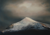
Rùm, the largest of The Small Isles, has a population of only about 20 or so people, all of whom live in the village of Kinloch on the east coast and work for Scottish Heritage or similar. Kinloch is at the head of Loch Scresort, the main anchorage. The Sound of Arisaig separates the Arisaig peninsula to the north from the Moidart peninsula to the south. There are a number of small islands in the sound, the largest of which is Eilean nan Gobhar and Samalaman Island. See Rùm photo of below ...

28th July – Arisaig to Loch Nevis: Past Loch Moidart – which Richard described as a hard entrance - we continued up past Loch Ailort and then past Mallaig, into Loch Nevis and moored at the visitor’s mooring at ‘The Old Forge’ at Inverie at Knoydart, which, with no roads in or out, either an 18 mile hike over Munros or a 7 mile sea crossing, this pub claims to be the remotest on mainland Britain. I couldn’t have mussels as a starter – Richard had Stalkers Salad and we both had Lobster for a main course – but thought it a bit tough.

John and Janet Trythall – Contessa 32 owners – came aboard and I found out she was a retired anesthetist and he was a retired physics and outdoor teacher at Gordonstoun. Their Contessa is called Jaywalker – CO 9910C and they are from Elgin.
29th July – Loch Nevis to Loch Hourn: A short cruise (about 18 nM) but to the wildest (and wettest) loch I had anchored in … thus far.
30th July – Loch Hourn to Plockton: Left the Loch but the excitement was to come – up through the Kyle Rhea, the strait splitting Skye from the mainland. A ferry service (now March to October only) has linked Kylerhea with Glenelg on the mainland for centuries. We shot up through with me at the helm and Richard telling me to concentrate as we did 7+ knots or so. We broke out into Loch Alsh in windy conditions and sailed up to see (from a distance) in Loch Duich the castle Eilean Donan. We then turned and had lunch tied up at Kyle of Lochalsh.
After lunch we past the sight - in the distance – of Raasay and Scalpay and near to, (once we had past under the Skye Bridge), Longay and Eilean Mor (and Eilean Meadhonach). We had Applecross on our port as we sailed up Loch Carron. We moored in Plockton (on John & Janet Trythall’s mooring). Had a shower at Heathers … very welcome though Richard wasn’t bothered! I waited for him – at the wrong pontoon apparently – I was pretty cold when he turned up!

31st July – Plockton to Doune Bay: Back under the Skye Bridge and down through Loch Alsh and through the Kylerhea at 2pm… we made a stop at Richard’s reckoning at Doune Bay (he thought Mallaig would be noisy).

This is when the electrics failed on us! I had a restless night too, having to get up when the mooring buoy wrapped around the mooring rope and clanged on the hull … twice! I finally sorted it at about 1:30 in the morning.
1st August – Doune Bay to Oronsay’s Loch na Droma Buidhe: Richard woke me at something before 6 am wanting us to get off and round Ardnamurchan Point having heard about the foul weather coming in. We got to Tobermory in pouring rain and bad wind only to be told that because of West Highland Week we couldn’t be accommodated … so we sailed/motored across a stormy sea to Loch na Droma Buidhe and anchored at the top of the bay in about 20 metres! Though she swung a lot, the boat always turned to face the anchoring point, even if it was just before it turned completely.
2nd August - Loch na Droma Buidhe to Tobermory: We had a very late start in spite of being up reasonably early as Richard thought it mad to go out in bad wind. I watched some windsurfing from a cutter anchored near us for a while whilst Richard read below. After lunch, at about 2.30 we set off. Once we were at the top of the Sound it seemed really rough and confused so we went into Tobermory and got a pontoon (much to Richard’s disgust probably!) - though the electrics came back once we had shore-power(?). We ate a fish & chip takeaway, after a coffee and replenishing our milk and bread at the Coop.
3rd August – Tobermory to Dunstaffnage: A windy, wet but brilliant sail down the Sound and across out of the Firth of Lorne - out across Ardmucknish Bay to Dunstaffnage. Got in at about 3:30 having set off at about 9:30 at Tobermory.

27th July - Loch na Droma Buidhe - round Ardamurchan Point (The Hill Of The Great Sea) – which struck me as a big deal – to Arisaig: As we sailed up past the Point

I looked west and saw the Small Isles - well at least the Isles of Muck, Eigg and Rum. Muck - the smallest of them - called Eilean nam Muc in Gaelic, is low lying and quite arable and offers two safe anchorages:- Gallanach to the north 56° 50.5’ North 06° 15.5’ West To enter the bay line up the green Dutch barn adjacent to the white farm buildings with the dry stone wall leading up to the cliffs on the other side of the island. The holding is good with a sand bottom. There is also Port Mor to the south 56° 49.6’ North 06° 13.0’ West which is much easier to navigate with a clearly buoyed channel perches at the entrance and a Sectored Light. The holding in Port is also good with a sandy bottom. Here there is the Craft Shop and Tea Room for refreshments and evening meals are available at the Craft Shop (01687 462990/460057) or Port Mor House Hotel (01687 462365). Meals need to be booked well in advance. See below ...

The Isle of Eigg is nearly 6 miles long and 3 miles wide (second largest of The Small Isles) is quite a recognisable shape, thanks to An Sgurr - which is 1,289 feet in height. The main settlement is Cleadale on a fertile coastal plain in the north west. Eigg is known for its quartz beach, called the "singing sands" (Tràigh a' Bhìgeil) on account of the squeaking noise it makes if walked on when dry. After decades of problems with absentee landlords in the 20th century, Eigg was bought in 1997 by the Isle of Eigg Heritage Trust, a partnership between the residents of Eigg, the Highland Council, and the Scottish Wildlife Trust. The story of this community buy-out is told in Alastair McIntosh's book Soil and Soul: People Versus Corporate Power published in 2001. At the time, the population was around 60. In 2012, Eigg has 90 residents, many of them young people who have returned to the island or who have moved there to make it their home and set up in business. See Eigg below!

Rùm, the largest of The Small Isles, has a population of only about 20 or so people, all of whom live in the village of Kinloch on the east coast and work for Scottish Heritage or similar. Kinloch is at the head of Loch Scresort, the main anchorage. The Sound of Arisaig separates the Arisaig peninsula to the north from the Moidart peninsula to the south. There are a number of small islands in the sound, the largest of which is Eilean nan Gobhar and Samalaman Island. See Rùm photo of below ...

28th July – Arisaig to Loch Nevis: Past Loch Moidart – which Richard described as a hard entrance - we continued up past Loch Ailort and then past Mallaig, into Loch Nevis and moored at the visitor’s mooring at ‘The Old Forge’ at Inverie at Knoydart, which, with no roads in or out, either an 18 mile hike over Munros or a 7 mile sea crossing, this pub claims to be the remotest on mainland Britain. I couldn’t have mussels as a starter – Richard had Stalkers Salad and we both had Lobster for a main course – but thought it a bit tough.

John and Janet Trythall – Contessa 32 owners – came aboard and I found out she was a retired anesthetist and he was a retired physics and outdoor teacher at Gordonstoun. Their Contessa is called Jaywalker – CO 9910C and they are from Elgin.
29th July – Loch Nevis to Loch Hourn: A short cruise (about 18 nM) but to the wildest (and wettest) loch I had anchored in … thus far.

30th July – Loch Hourn to Plockton: Left the Loch but the excitement was to come – up through the Kyle Rhea, the strait splitting Skye from the mainland. A ferry service (now March to October only) has linked Kylerhea with Glenelg on the mainland for centuries. We shot up through with me at the helm and Richard telling me to concentrate as we did 7+ knots or so. We broke out into Loch Alsh in windy conditions and sailed up to see (from a distance) in Loch Duich the castle Eilean Donan. We then turned and had lunch tied up at Kyle of Lochalsh.
After lunch we past the sight - in the distance – of Raasay and Scalpay and near to, (once we had past under the Skye Bridge), Longay and Eilean Mor (and Eilean Meadhonach). We had Applecross on our port as we sailed up Loch Carron. We moored in Plockton (on John & Janet Trythall’s mooring). Had a shower at Heathers … very welcome though Richard wasn’t bothered! I waited for him – at the wrong pontoon apparently – I was pretty cold when he turned up!

31st July – Plockton to Doune Bay: Back under the Skye Bridge and down through Loch Alsh and through the Kylerhea at 2pm… we made a stop at Richard’s reckoning at Doune Bay (he thought Mallaig would be noisy).

This is when the electrics failed on us! I had a restless night too, having to get up when the mooring buoy wrapped around the mooring rope and clanged on the hull … twice! I finally sorted it at about 1:30 in the morning.
1st August – Doune Bay to Oronsay’s Loch na Droma Buidhe: Richard woke me at something before 6 am wanting us to get off and round Ardnamurchan Point having heard about the foul weather coming in. We got to Tobermory in pouring rain and bad wind only to be told that because of West Highland Week we couldn’t be accommodated … so we sailed/motored across a stormy sea to Loch na Droma Buidhe and anchored at the top of the bay in about 20 metres! Though she swung a lot, the boat always turned to face the anchoring point, even if it was just before it turned completely.
2nd August - Loch na Droma Buidhe to Tobermory: We had a very late start in spite of being up reasonably early as Richard thought it mad to go out in bad wind. I watched some windsurfing from a cutter anchored near us for a while whilst Richard read below. After lunch, at about 2.30 we set off. Once we were at the top of the Sound it seemed really rough and confused so we went into Tobermory and got a pontoon (much to Richard’s disgust probably!) - though the electrics came back once we had shore-power(?). We ate a fish & chip takeaway, after a coffee and replenishing our milk and bread at the Coop.
3rd August – Tobermory to Dunstaffnage: A windy, wet but brilliant sail down the Sound and across out of the Firth of Lorne - out across Ardmucknish Bay to Dunstaffnage. Got in at about 3:30 having set off at about 9:30 at Tobermory.
The Highland Midge

The Highland midge (Culicoides impunctatus) - or Midgie or in the gaelic Meanbh-chuileag - is a species of small flying insect found in upland and lowland areas (fens, bogs and marshes) especially in the north west of Scotland from late spring to late summer. Female Highland midges are well known for gathering in clouds and biting humans,

and are the smallest flies in Scotland to do so, though the majority of the blood they obtain comes from cattle, sheep and deer. They are generally regarded as pests.

Despite Scotland's exceptionally cold winter in the early part of 2010, scientists discovered that after the prolonged freezing conditions, rather than reducing in number actually increased the following summer due to the cold weather reducing its natural predators, such as bats and birds. The female midges tend to bite in close proximity to the breeding site (although they have been found up to 1 km away) and near to the ground, and are most active just before sunset. Midges are less active after sunset, as well as with wind speeds of over 6 mph, or humidity below 60-75%.
Tuesday, 23 July 2013
2013 June - second sail of the season with Stan & Jane
Stan & Jane came up and stayed the night of the 10th June. Margaret and I had a meal in with them and then, the next day on the Tuesday Stan & Jane plus myself set off North in their car.
We got to Dunstaffnage at around 4pm where I got the keys and we transferred all the relevant gear to the boat, which seemed in good nick. We did a shop at the Coop in Oban at around 6pm and then had dinner in Room 9 Restaurant and turned in when we got back after a drink in the Wide Mouthed Frog.
On the Wednesday we motored out and sailed across to Loch Etive to stay the night at the new Pontoon/Shower Block.
Walked to the Ardtornish Estate

Thursday saw us sailing up the Sound of Mull to Tobermory, where we stayed two nights, one full day. On the first night we ate on board - really nice .... The next day we spent going around the area of Tobermory - for example the Mull Museum in Tobermory crams a great deal of information into a very small space. They could have a room three times the size and it would still be full. ... We also strolled around the front, buying some beer at the Coop. Stan bought a fishing rod set and we went to the Ferry terminal. Then we went up to 'An Tobar' to have lunch and saw Fred Schley's painting exhibition and Sam Jones' photography exhibition.

Then a lazy afternoon sorting out some sail issues with the genoa, and at night we went to see "Why Do You Stand There in the Rain?" at the Mull Theatre is based at Druimfin, just outside Tobermory. The play is about the "Bonus Army," who, 80 years before the current "Occupy movement," marched on Washington DC. WWI vets, as part of compensation for war wages, were promised bonus compensation when they died or retired. Hundreds of thousands of veterans were out of work during the depression. They asked the government 'give our bonus to us now.' There were protests. In 1932 they occupied Washington D.C. Veterans and their families built a Hoover town. They called it the 'Bonus Army.' It was just like the occupy movement. In the end, the military was called in, and the protesters were cleared out by troops commanded by Generals Douglas MacArthur and George Patton. A cavalry charge, followed by troops armed with fixed bayonets and canisters of adamsite gas-an arsenic-based tear gas-were used to disperse the protesters, while spectators reportedly called "shame,shame! According to newspaper reports, approximately 10,000 men, women and children took part in the Bonus Army protest, 55 were injured and 135 arrested. A 12-month-old baby allegedly died from tear gas exposure and a woman miscarried. The Senate defeated the bill that would have allocated the bonus funds to the veterans by a vote of 62 to 18. The play was excellent!
Displays include the geology of the island; prehistory including Standing Stones, Duns and Brochs; the visit of Johnson and Boswell; the wreck of a Spanish galleon from the Armada fleet; the arrival of a ship from Newfoundland which had been blown off course across the Atlantic; the planned development of Tobermory in the nineteenth century as a fishing port; crafting, farming and other trades; the village school, etc.
On the Saturday we sailed across to Salen in Loch Sunart.
On the Sunday we came back down the Sound after motoring out of the loch and sailed to Dunstaffnage (though we motored the last bit).
On Stan's 60th we had to motor to Port Appin
Back to Dunstaffnage and stayed the night - then tidied up on the Monday and left at 11:00ish an got home at 4:30ish and then after some time at home wnet to Westbourne Spice for a curry. Stan & Jane left next morning.
We got to Dunstaffnage at around 4pm where I got the keys and we transferred all the relevant gear to the boat, which seemed in good nick. We did a shop at the Coop in Oban at around 6pm and then had dinner in Room 9 Restaurant and turned in when we got back after a drink in the Wide Mouthed Frog.
On the Wednesday we motored out and sailed across to Loch Etive to stay the night at the new Pontoon/Shower Block.
Walked to the Ardtornish Estate

Thursday saw us sailing up the Sound of Mull to Tobermory, where we stayed two nights, one full day. On the first night we ate on board - really nice .... The next day we spent going around the area of Tobermory - for example the Mull Museum in Tobermory crams a great deal of information into a very small space. They could have a room three times the size and it would still be full. ... We also strolled around the front, buying some beer at the Coop. Stan bought a fishing rod set and we went to the Ferry terminal. Then we went up to 'An Tobar' to have lunch and saw Fred Schley's painting exhibition and Sam Jones' photography exhibition.
Then a lazy afternoon sorting out some sail issues with the genoa, and at night we went to see "Why Do You Stand There in the Rain?" at the Mull Theatre is based at Druimfin, just outside Tobermory. The play is about the "Bonus Army," who, 80 years before the current "Occupy movement," marched on Washington DC. WWI vets, as part of compensation for war wages, were promised bonus compensation when they died or retired. Hundreds of thousands of veterans were out of work during the depression. They asked the government 'give our bonus to us now.' There were protests. In 1932 they occupied Washington D.C. Veterans and their families built a Hoover town. They called it the 'Bonus Army.' It was just like the occupy movement. In the end, the military was called in, and the protesters were cleared out by troops commanded by Generals Douglas MacArthur and George Patton. A cavalry charge, followed by troops armed with fixed bayonets and canisters of adamsite gas-an arsenic-based tear gas-were used to disperse the protesters, while spectators reportedly called "shame,shame! According to newspaper reports, approximately 10,000 men, women and children took part in the Bonus Army protest, 55 were injured and 135 arrested. A 12-month-old baby allegedly died from tear gas exposure and a woman miscarried. The Senate defeated the bill that would have allocated the bonus funds to the veterans by a vote of 62 to 18. The play was excellent!
Displays include the geology of the island; prehistory including Standing Stones, Duns and Brochs; the visit of Johnson and Boswell; the wreck of a Spanish galleon from the Armada fleet; the arrival of a ship from Newfoundland which had been blown off course across the Atlantic; the planned development of Tobermory in the nineteenth century as a fishing port; crafting, farming and other trades; the village school, etc.
On the Saturday we sailed across to Salen in Loch Sunart.
On the Sunday we came back down the Sound after motoring out of the loch and sailed to Dunstaffnage (though we motored the last bit).
On Stan's 60th we had to motor to Port Appin
Back to Dunstaffnage and stayed the night - then tidied up on the Monday and left at 11:00ish an got home at 4:30ish and then after some time at home wnet to Westbourne Spice for a curry. Stan & Jane left next morning.
Subscribe to:
Posts (Atom)